
Eco-informatics uses computer science and data analysis tools to aid in the observation, understanding and ultimately prediction of environmental system behavior.
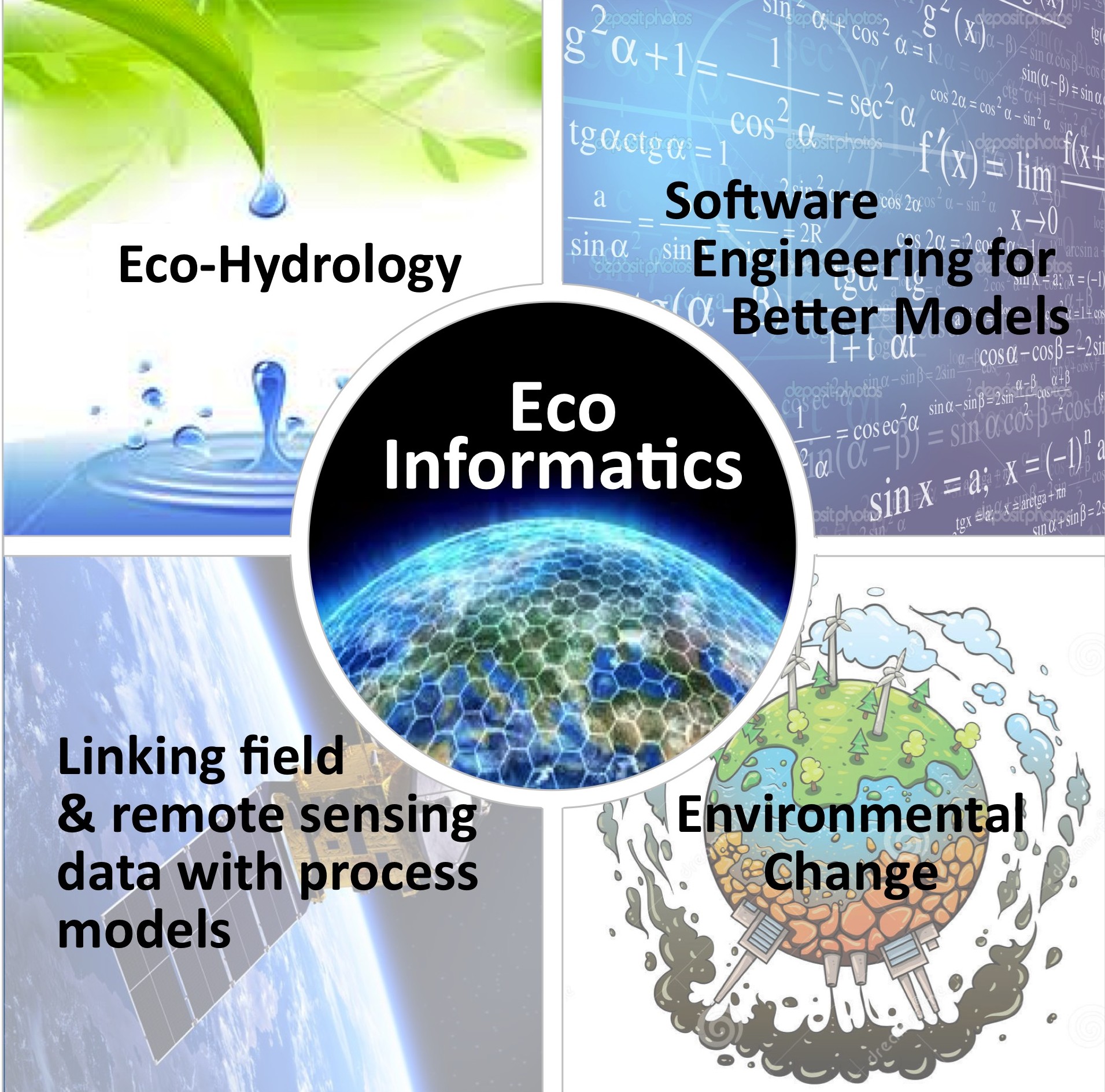
Our lab group specializes in eco-informatics related to understanding the terrestrial environment and how it processes water, energy, nutrients, and carbon. We specialize in the design and application of dynamic simulation models and linking these models with multiple data sources (from remote sensing to on the ground measurements).
While many models of ecosystem process and hydrology exist, we seek to improve on these approaches by:
- expanding the capacity of models to integrate an increasingly wide range of available data sets that vary in type, scale, resolution and accuracy;
- improve how we visualize the multi-dimensional outputs from models and tailor these visualizations for different audiences – from the public to field-based researchers. For more information on our work in this area, please see our publication “Visualization and ecohydrologic models: Opening the box“.
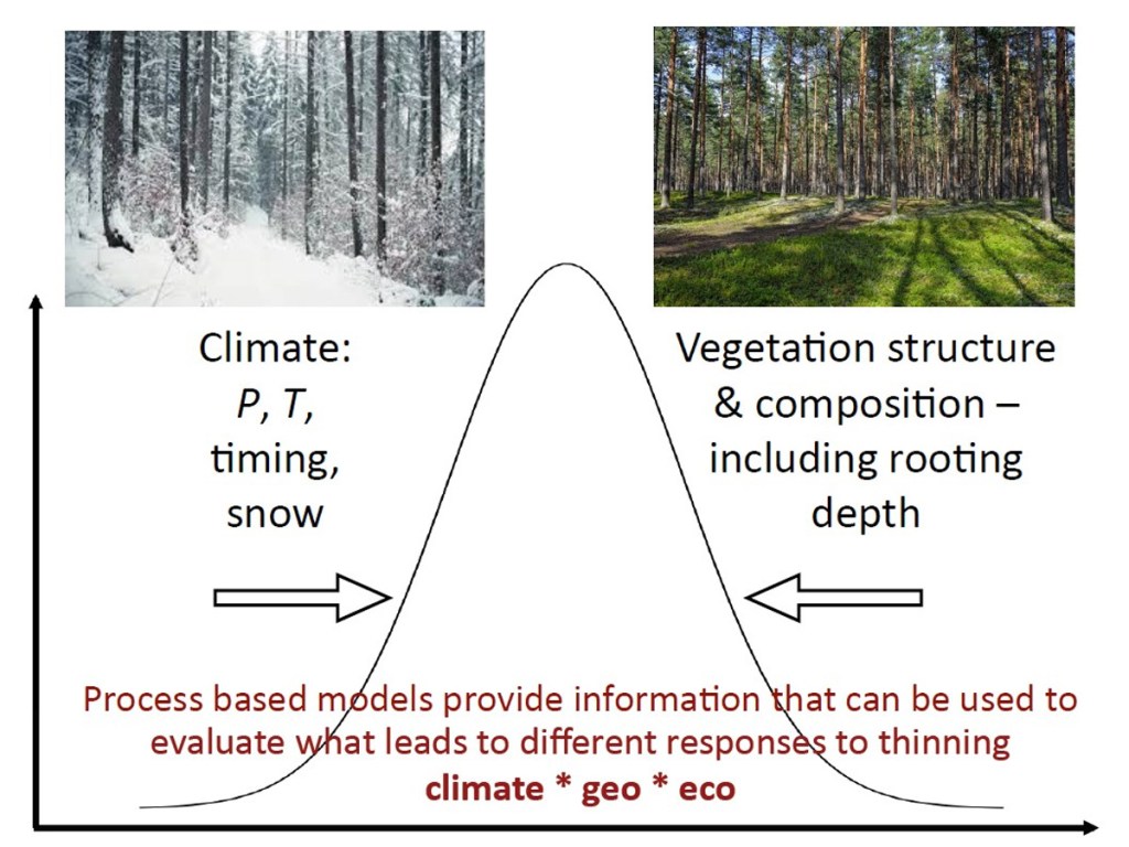
- integrate new understanding of ecosystem and hydrologic processes that emerges from ongoing science investigation – so that models become libraries of state-of-the art mechanistic understanding
Well-known computer scientist, Jim Gray coined the phrase “fourth paradigm” to describe an era where data-driven science unifies “theory, experiment and simulation”.
Our group moves ecohydrology into this era by combining existing simulation and theory with ongoing natural science experiments and data collection in a virtual observatory.
RHESSys: The Regional Hydro-Ecologic Simulation System
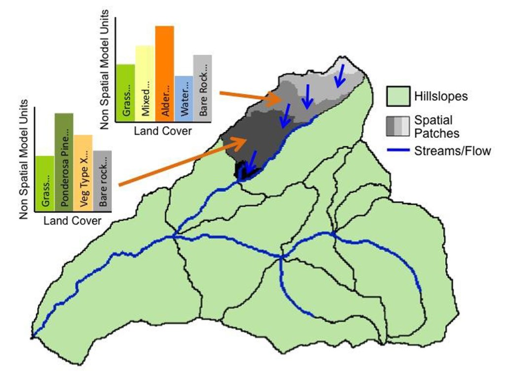
A core lab product is RHESSys (Regional Ecohydrologic Simulation System): a community based tool that simulations multiple environmental processes (eg. water cycling, vegetation growth, urban runoff, fire, carbon sequestration, nutrient export, climate change impacts) over space and time: We use state-of-the art software engineering techniques to evolve this tool.
We use RHESSys as a framework for exploring and testing advances in data-model integration, looking at data-assimilation of temporal and spatial data, efficient calibration techniques representing uncertainty improving model structure.
Explore the RHESSys Possibilities
Visit the RHESSys Website
Visit the RHESSys Wiki
Download the RHESSys Code
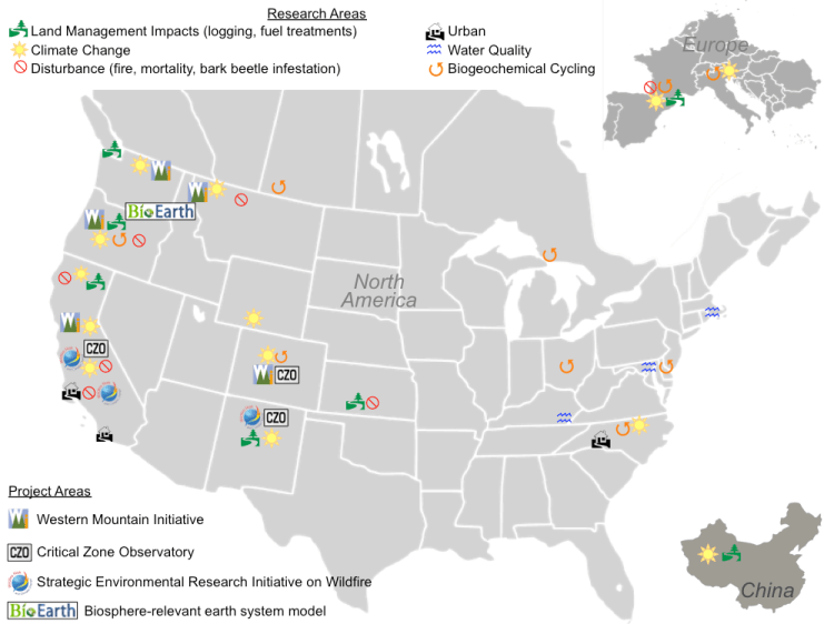
Current Areas of Model Development
Applications and Aspects
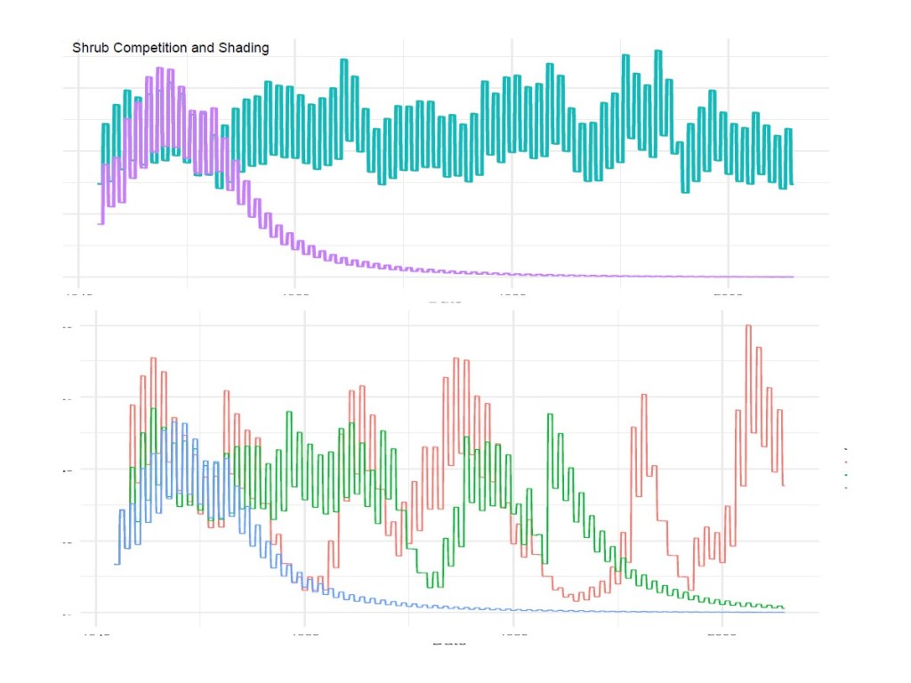
- Plant carbon allocation
- Vegetation mortality
- Assimilation of new snow remote sensing products
- Hot-spot-hot-moments in terrestrial biogeochemical cycling
- Models of storm water best management practices
- Use of LiDAR and other remote to initialize vegetation carbon stores
- Fire effects on terrestrial ecosystems, nutrient cycling and hydrology
- Use of geophysics data and remote sensing of vegetation to parameterize subsurface flow properties
Workflows and Practices
- Automated workflows
- Data assimilation
- Improved process representation
- Automated testing of model components
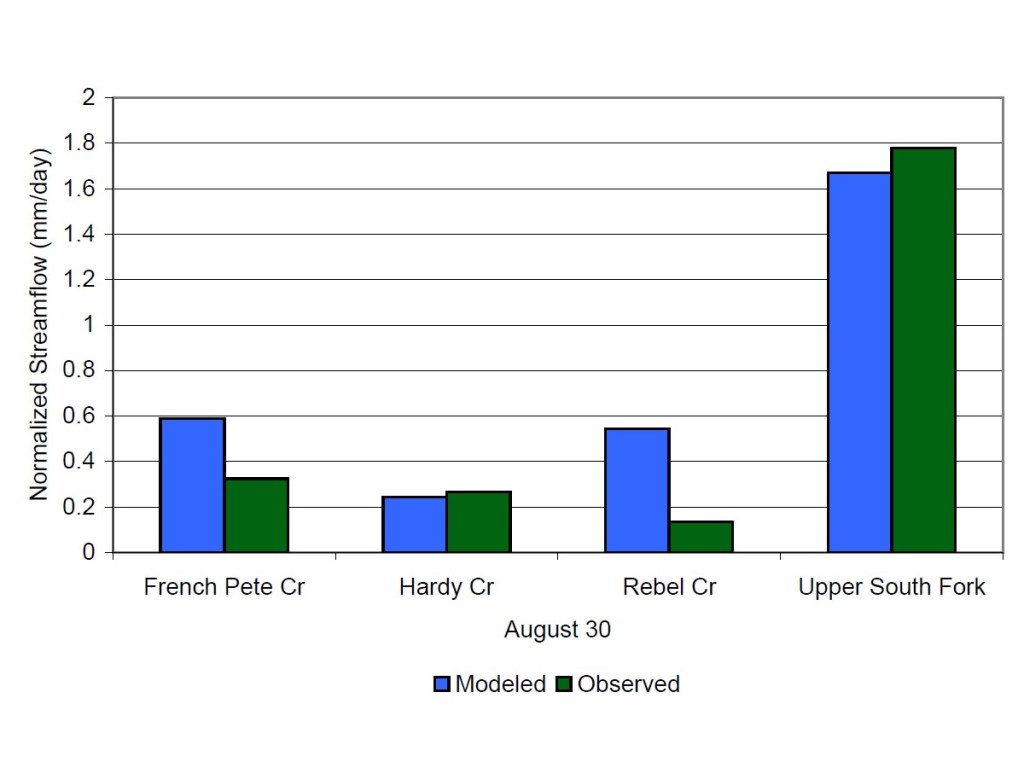
- Evaluation against observed data sets
Visualization and Communication
- Integrating RHESSYs with R visualization tools
- Community based software development
- Training and education in the design and application of models
- Flexible user interface development
- Modeling software development and training
- Collaborations with artists to represent model results
Related Poster Presentations
The following are recent poster presentations given by members of our lab at various conferences. Click a figure to view the presentation.
Relevant Publications
The following papers describe software and model development strategy, testing and innovation.
- Tague, C., Frew, J. (2020) Visualization and ecohydrologic models: Opening the box, Hydrological Processes 35(1): e13991. doi:10.1002/hyp.13991.
- Bart, R.R., Kennedy, M.C., Tague, C.L., McKenzie, D. (2019) Integrating fire effects on vegetation carbon cycling within an ecohydrologic model, Ecological Modelling 416(2020): 108880. doi:10.1016/j.ecolmodel.2019.108880.
- Hanan, E., Tague, C., Choate, J., Liu, M., Kolden, C., Adam, J.C., (2018) Accounting for disturbance history in models: using remote sensing to constrain carbon and nitrogen pool spin-up, Ecological Applications. 28(5): 1197-1214. doi:10.1002/eap.1718.
- Kennedy, M.C., McKenzie, D., Tague, C., Dugger, A.L. (2017) Balancing uncertainty and complexity to incorporate fire spread in an eco-hydrological model, J. Wildland Fire 26(8): 706–718. doi:10.1071/WF16169.
